


VTD NU10, Pennington County, South Dakota
About
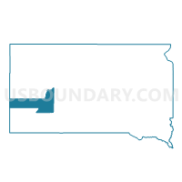
Outline

Summary
| Unique Area Identifier | 667687 |
| Name | VTD NU10 |
| County | Pennington County |
| State | South Dakota |
| Area (square miles) | 322.36 |
| Land Area (square miles) | 322.17 |
| Water Area (square miles) | 0.19 |
| % of Land Area | 99.94 |
| % of Water Area | 0.06 |
| Latitude of the Internal Point | 44.01010020 |
| Longtitude of the Internal Point | -102.72362800 |
Maps


Graphs
Select a template below for downloading or customizing gragh for VTD NU10, Pennington County, South Dakota


Neighbors
Neighoring Voting District (by Name) Neighboring Voting District on the Map
- VTD - CA19, Pennington County, SD
- VTD - DG7, Pennington County, SD
- VTD - SC11, Pennington County, SD
- VTD - WA12, Pennington County, SD
- VTD - WL15, Pennington County, SD
- VTD precinct Hermosa, Custer County, SD
- VTD-precinct 17 - Viewfield, Meade County, SD
- VTD-precinct 18 - ElmSprings, Meade County, SD
Top 10 Neighboring County Subdivision (by Population) Neighboring County Subdivision on the Map
- Rapid City East UT, Pennington County, SD (1,988)
- Belle Fourche-Cheyenne Valleys UT, Meade County, SD (1,839)
- East Custer UT, Custer County, SD (1,693)
- New Underwood city, Pennington County, SD (660)
- East Central Pennington UT, Pennington County, SD (384)
- Scenic township, Pennington County, SD (58)
- Lakeside township, Meade County, SD (53)
- Crooked Creek township, Pennington County, SD (29)
- Owanka township, Pennington County, SD (28)
- Wasta township, Pennington County, SD (13)
Top 10 Neighboring Place (by Population) Neighboring Place on the Map
Top 10 Neighboring Unified School District (by Population) Neighboring Unified School District on the Map
- Rapid City School District 51-4, SD (91,522)
- Meade School District 46-1, SD (18,211)
- Douglas School District 51-1, SD (11,829)
- Custer School District 16-1, SD (7,983)
- Wall School District 51-5, SD (1,497)
- New Underwood School District 51-3, SD (1,167)
Top 10 Neighboring State Legislative District Lower Chamber (by Population) Neighboring State Legislative District Lower Chamber on the Map
- State House District 33, SD (26,472)
- State House District 29, SD (25,322)
- State House District 30, SD (24,446)
Top 10 Neighboring State Legislative District Upper Chamber (by Population) Neighboring State Legislative District Upper Chamber on the Map
- State Senate District 33, SD (26,472)
- State Senate District 29, SD (25,322)
- State Senate District 30, SD (24,446)
Top 10 Neighboring 111th Congressional District (by Population) Neighboring 111th Congressional District on the Map
Top 10 Neighboring Census Tract (by Population) Neighboring Census Tract on the Map
- Census Tract 116, Pennington County, SD (6,720)
- Census Tract 9651, Custer County, SD (5,525)
- Census Tract 205, Meade County, SD (4,380)
Top 10 Neighboring 5-Digit ZIP Code Tabulation Area (by Population) Neighboring 5-Digit ZIP Code Tabulation Area on the Map
- 57703, SD (14,205)
- 57719, SD (6,217)
- 57744, SD (2,238)
- 57761, SD (1,210)
- 57790, SD (1,111)
- 57791, SD (190)
- 57725, SD (162)
- 57767, SD (149)
- 57780, SD (102)